Italy
Near intersection via Bozzalla with via Oropa, Pollone
Description:
Mill in Pollone Burcina Reserve
Status:
Already located!
Solution:
Near intersection via Bozzalla with via Oropa, Pollone
Lat/Lng:
45.586153925218916, 8.001472974278613
Found by:
Affiliate link
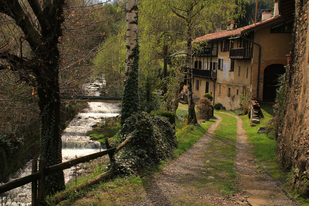
In the official Italian map (IGM) the fraction is called Trotti; I do not exclude that in the row of houses there is a former mill; I note the possible confusion with a very distant place, in Liguria, near Portofino, where the name Mulino remains near a secondary peak, called Monte Pollone ... and as always I don't see Instagram as a reliable source for mapping something. ;-)
In the Italian Alps most of the water mills have been abandoned in recent decades; the ruin is often found, but many mills have been demolished. Usually the mills were built on streams with a greater slope than this one.
Thnx for finding it. If it is really a mill I do not know, however I see mill stones in the external link photo.
Expanding to the maximum the scale from the point where I put the pin, I also see the pedestrian bridge.
Italy Pollone
The view on the map is identical, including the last roof without tiles, but I can't find a picture of the place. The street view is taken from the intersection via Bozzalla - via Oropa, 40m to the east.
external link
It doesn't look like a mill; I do not see a construction on the bank of the stream; for me it's just housing.
6 comments