China
Cuiping Village, Yangshuo, Guilin - View from Cuiping Hill
Description:
Found this on my computer... IDK where it is, I did not take this photo nor upload it.
Status:
Already located!
Solution:
Cuiping Village, Yangshuo, Guilin - View from Cuiping Hill
Lat/Lng:
24.890694496101517, 110.36405528749849
Found by:
Affiliate link
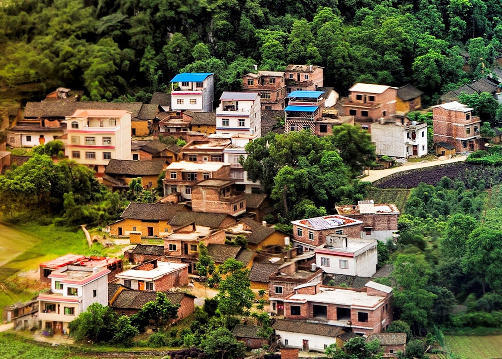
By the way, I did suggest Cuiping in my earlier comment, see where I said #4 in the photo gallery showing Cuiping Village from Wuzhi Hill (aka Cuiping Hill). However, Krenek said it didn't match.
Looking at this image, I believe Cuiping Village is the one on the left (abeit image may be flipped). The mystery place seems to be the village on the right side of the image.
external link
Google Map Image for Cuiping shows this image.
external link
Other Cuiping Village images seems to point to the place on the left of the panorama image.
external link
This China Discovery web site has Cuiping Village Photo address and directions in the 6th small image with best photo times. Seems again to indicate it is the village on the left of the big panorama.
external link
@krenek - In addition to my earlier comments I came across few more images which indicted the location as Cuiping Village, Yangshuo, Guilin - View from Cuiping Hill.
external link
Flickr - external link
Google Earth shows Cuiping at 24.888049, 110.378142 and also shows this photo
external link
So in my opinion the answer is Cuiping Village, Yangshuo, Guilin - View from Cuiping Hill.
I am marking the location at 24.892107 110.36826 as suggested by you.
@Admin - Please credit this to Krenek who was first in this region.
Have a look at GoogleEarth photos of Cuiping by Ring Ho, who is level 9 Local Guide of Google Maps, at following locations.
24.890552, 110.364091 - external link
24.889338, 110.362179 - external link
24.893444, 110.362157 - external link
24.894637, 110.360410 - external link
All the above locations are within half to one kilometer of each other. I feel you can safely mark the location at 24.890552, 110.364091.
see #5342
Thanks dagger66! Nice finds!
I was checking the Google non-360° images too but did not see that one yet!
We are close.
I guess, in that area, a lot of places look alike. For example: in your images, we can see a bridge + a village on the right then a bridge with a village on the left= it's of course not the same!
Google Maps does not show a lot of such little rivers. Map.qq quality of images is pretty bad with a lot of clouds...
Still searching!...
Nicaragua
Krenek ... I think this is a view of Putaozhen from Wuzhi Hill. You are the main solver, so I'm just offering this possible clue. I think the original images are flipped, or the posted photos. See below if you think this is a possibility.
The split in the waterway, bridge and building across the bridge seem to match.
external link
See #4 in this photo gallery.
external link
And maybe this alternative view from Google Map Images.
external link
15 comments